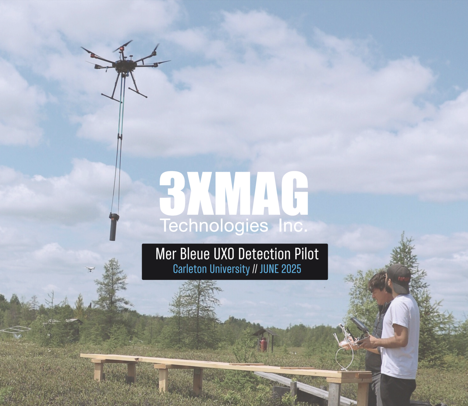
Ottawa, ON . Mer Bleue // JUNE 2025
45.39681695768917, -75.51267397007454
Mer Bleue UXO Detection Pilot Project
Mer Bleue UXO Detection Pilot — A Proven Defense Case Study
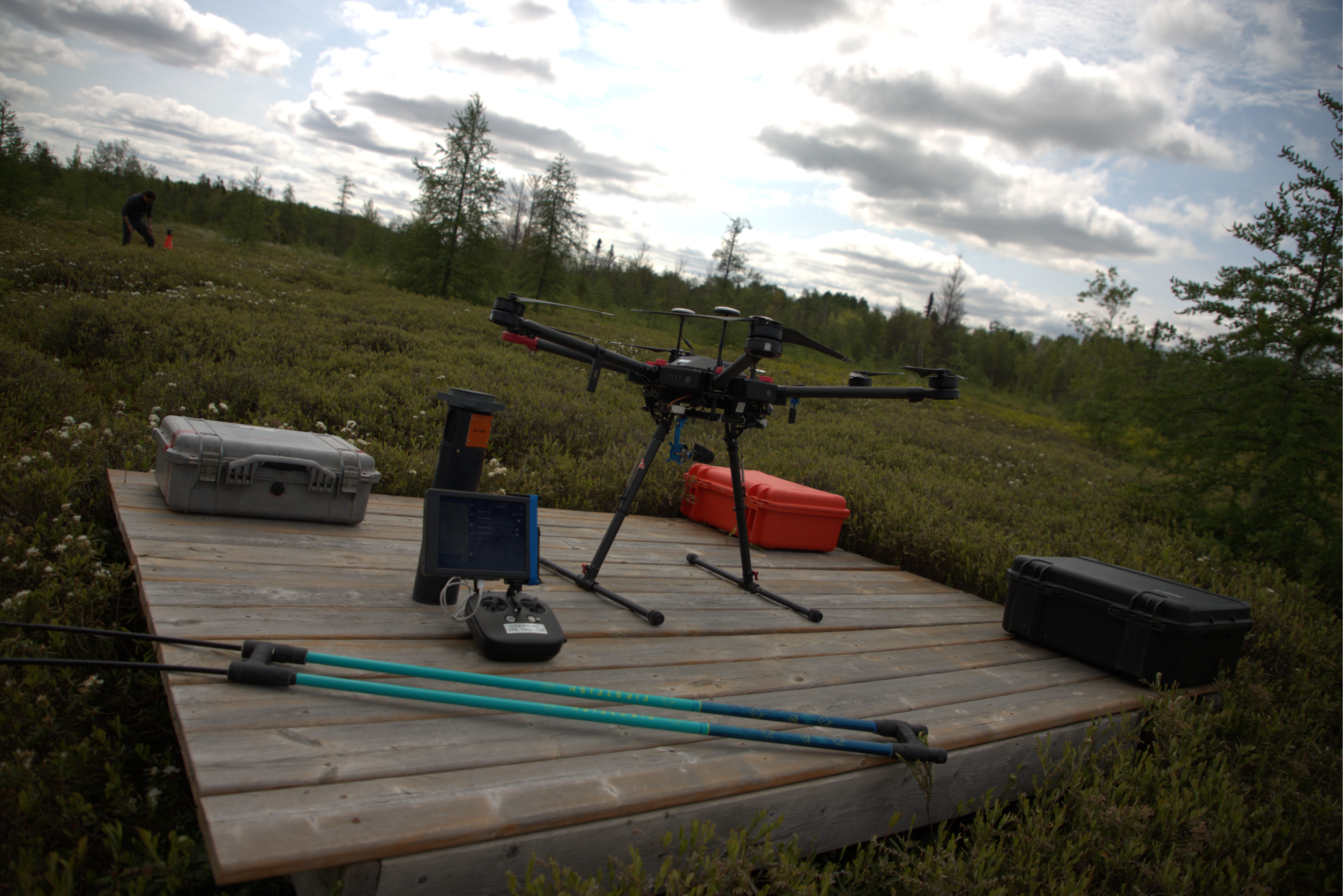
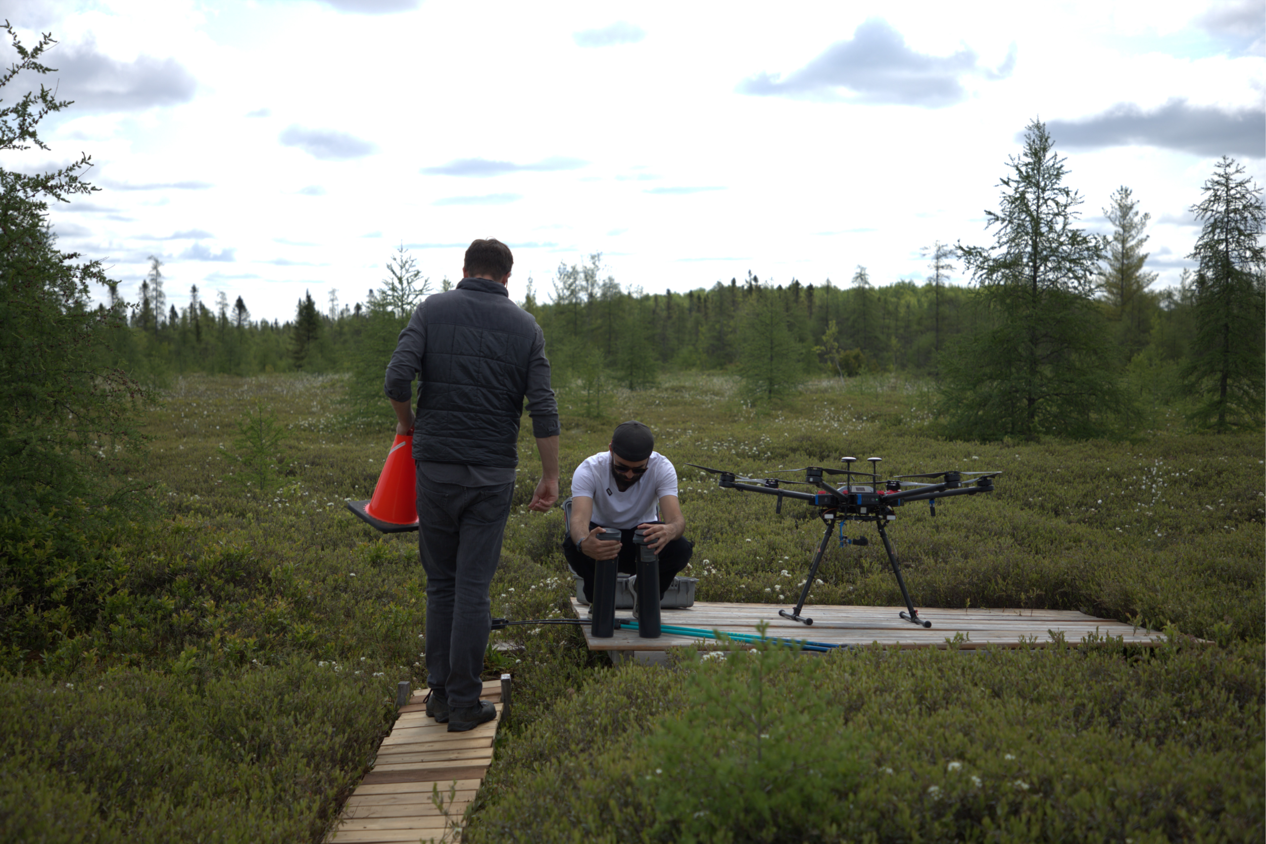
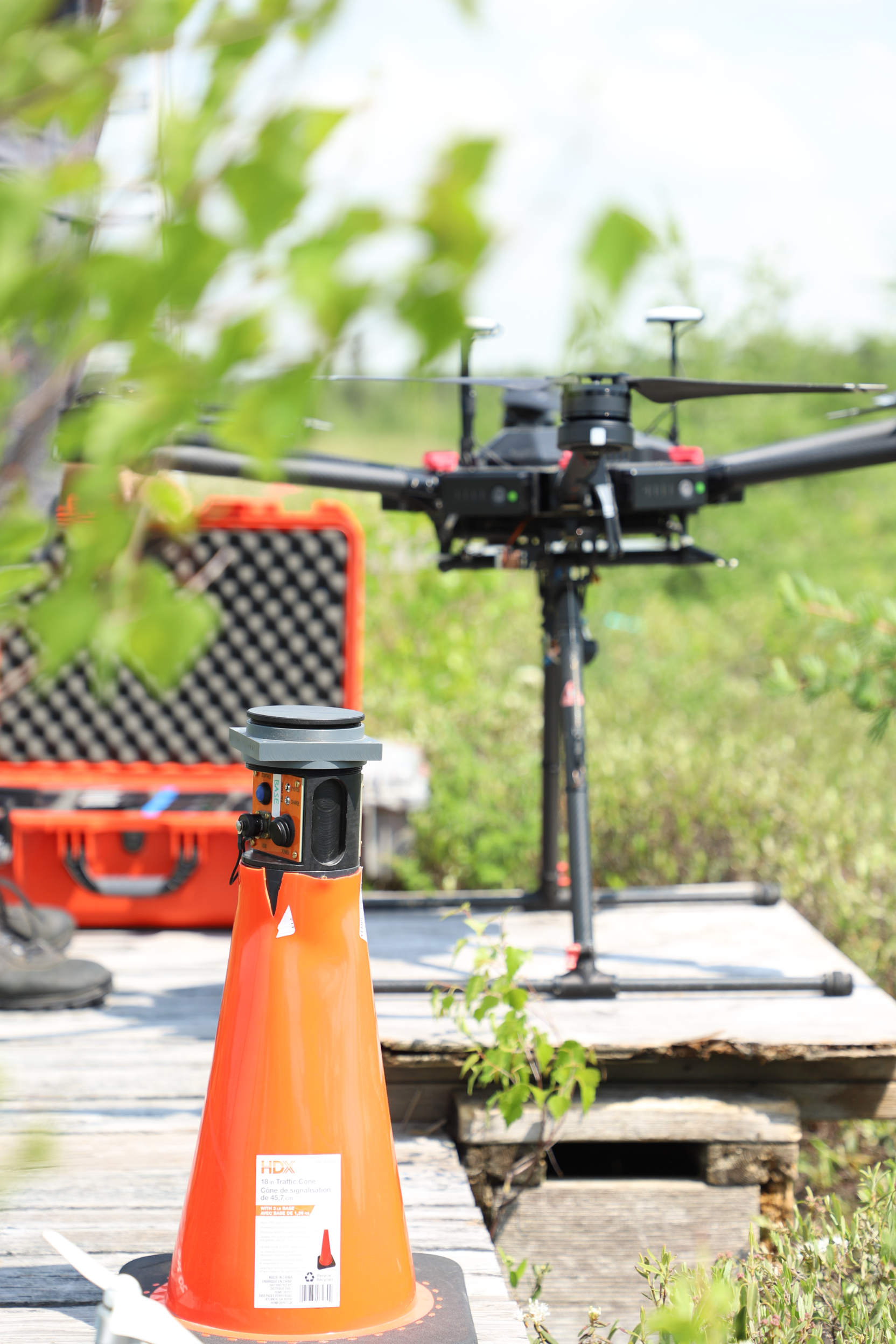
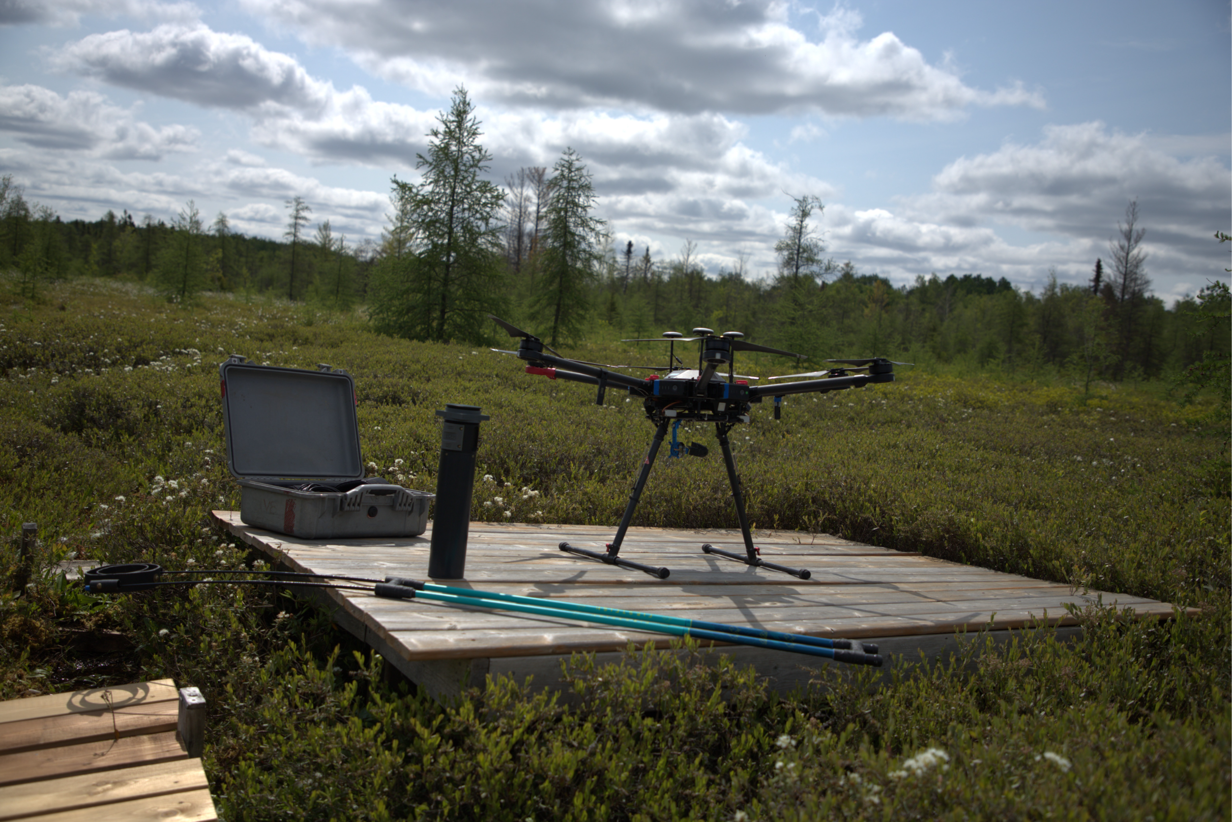
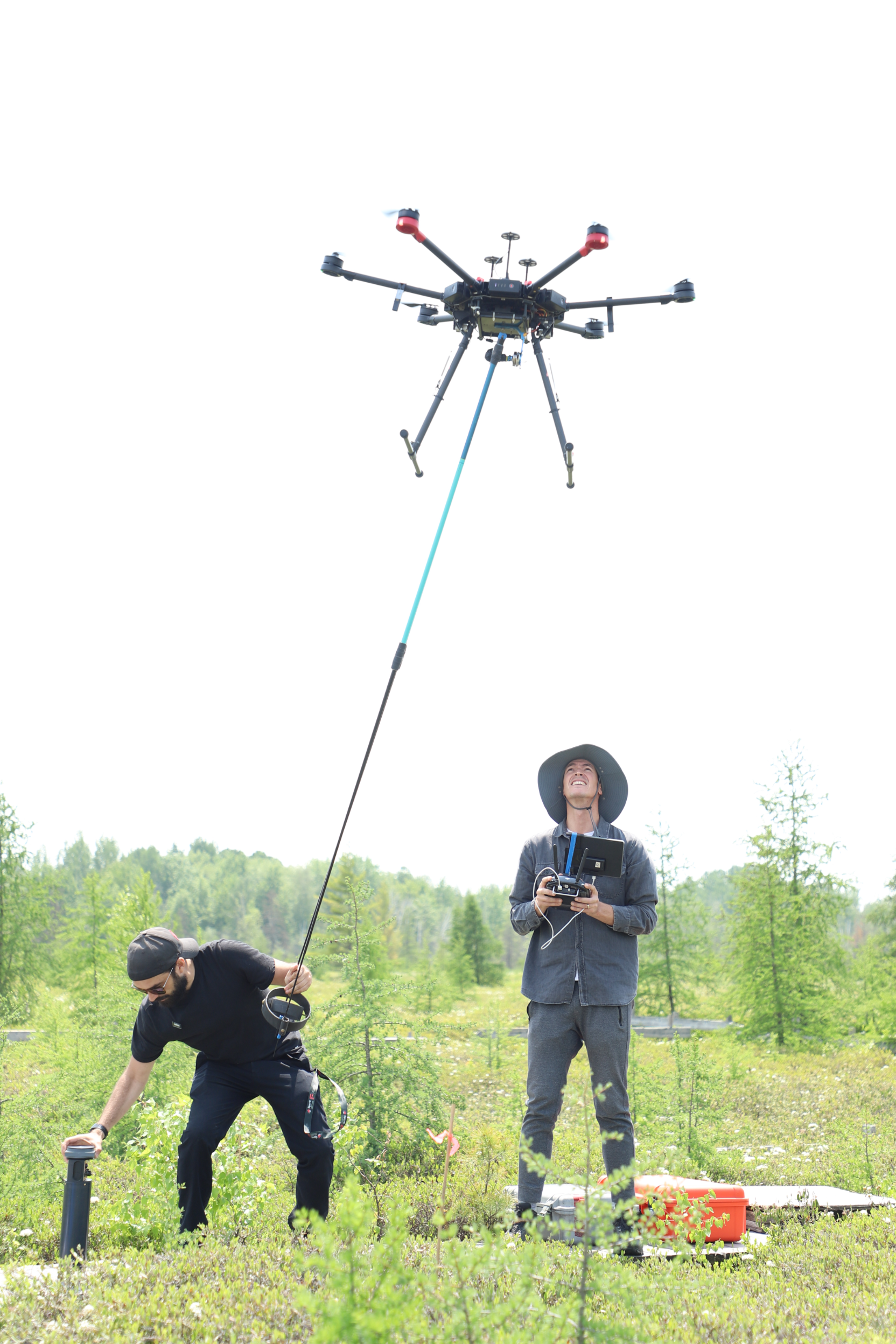
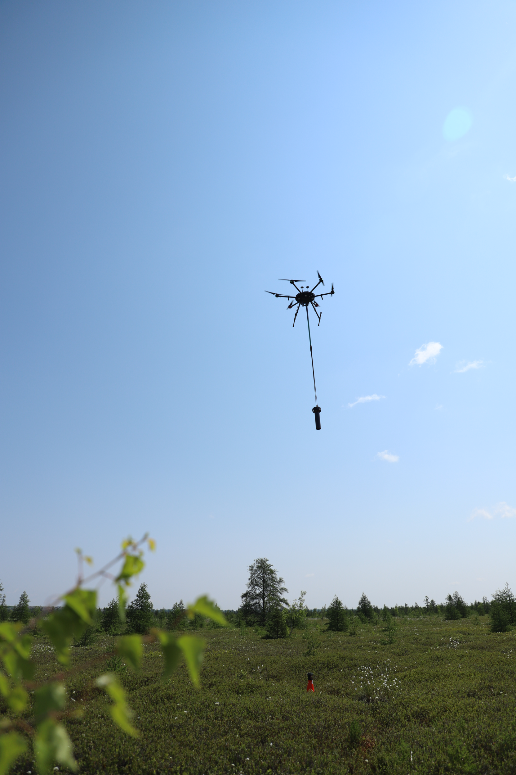
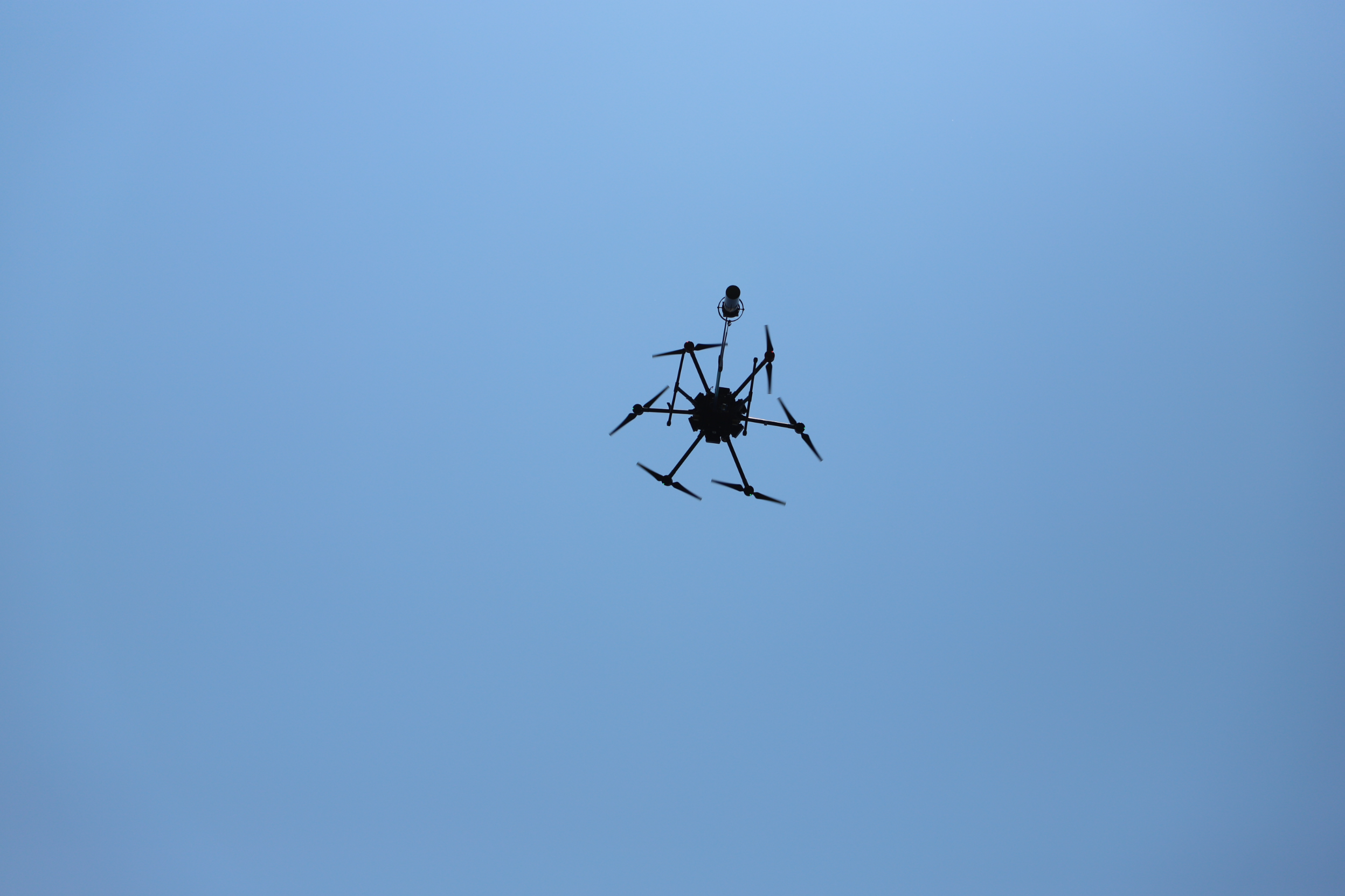
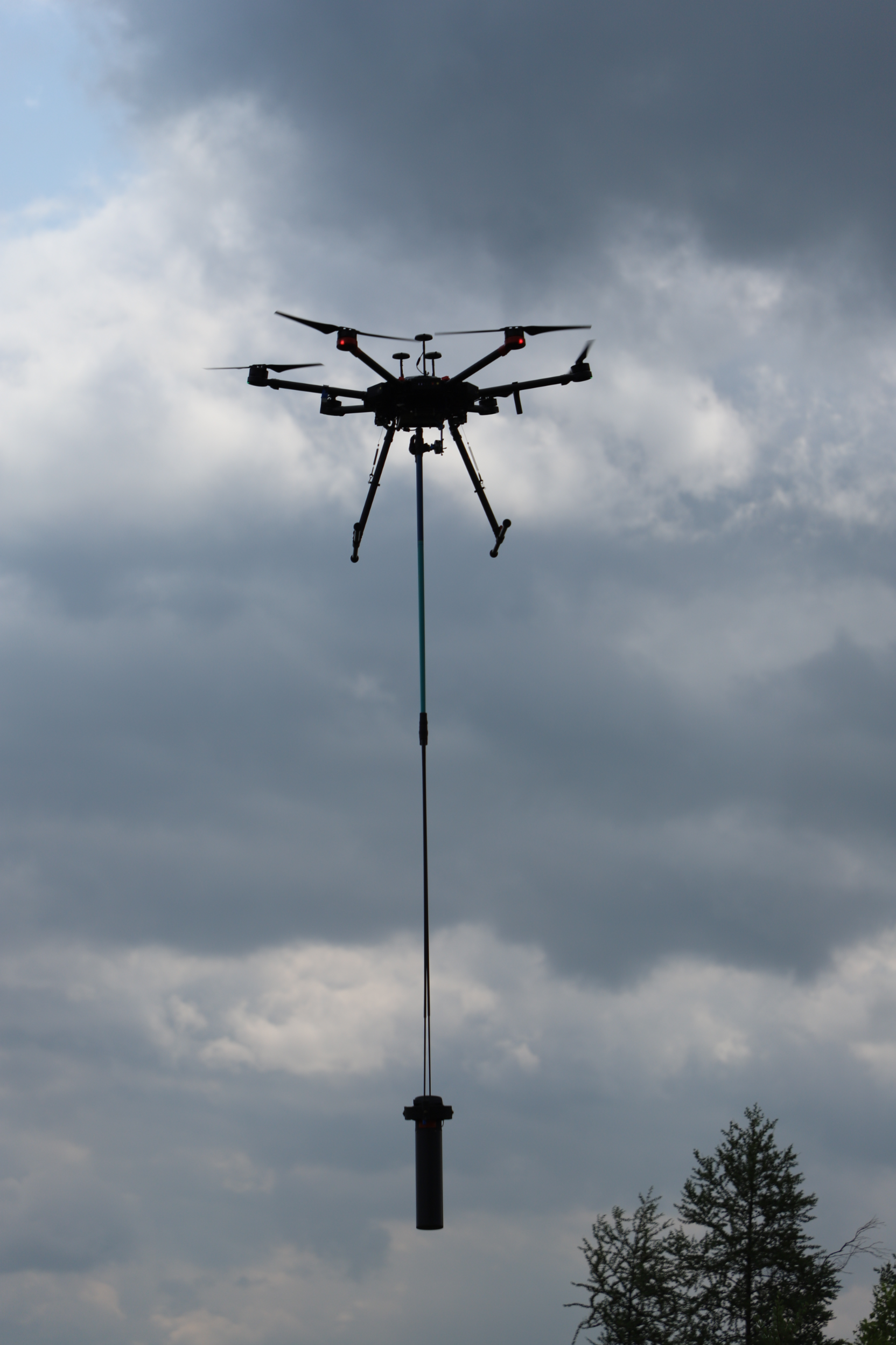
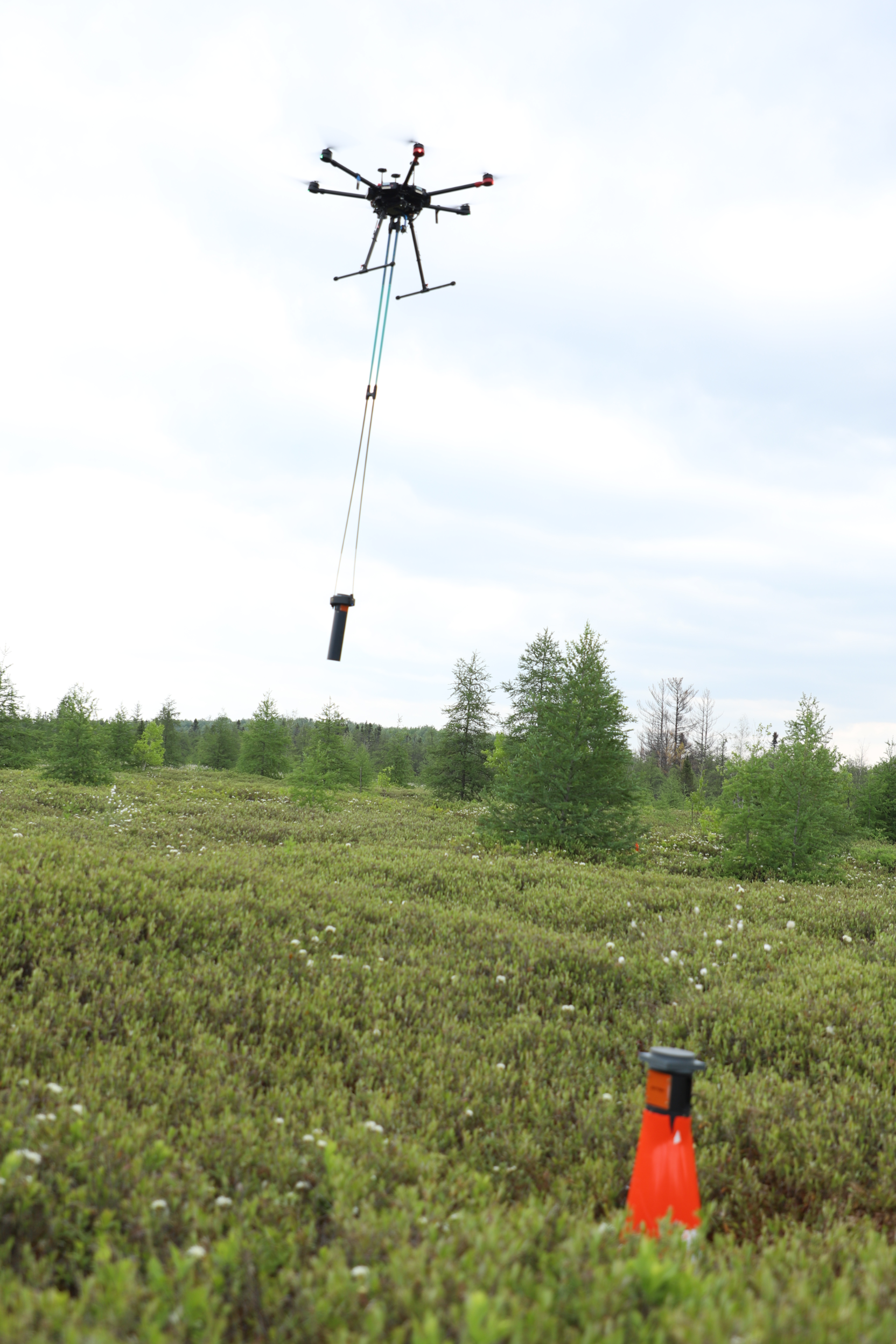
3XMAG Technologies Inc. has successfully completed a groundbreaking geophysical pilot project in Ottawa’s Mer Bleue wetlands, using UAV-based magnetometry and radiometry to detect WWII-era unexploded ordnance — safely, accurately, and non-invasively.
Our strategic briefing sessions at Carleton University brought together defense stakeholders, researchers, and industry innovators to explore how this real-world mission sets a new standard for next-generation geophysical survey technology.
This validated pilot is now a cornerstone case study for dual-use defense and environmental safety applications, demonstrating the value of advanced UAV workflows, multi-sensor integration, and AI-enhanced anomaly detection.
Sign up below to access the full case study, see the results for yourself, and stay connected as we scale this proven technology through research partnerships, field pilots, and commercial opportunities.
Join us // collaborate, innovate, and grow with
LEARN MORE

Linkedin
DOWNLOAD THE REPORT
PHOTOS
VIDEOS
Mer Bleue UXO Detection Pilot
Field-Proven Results & Strategic Briefings
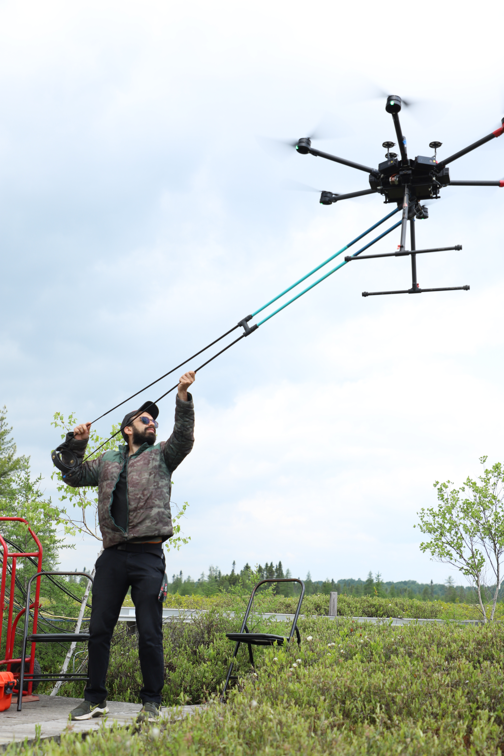
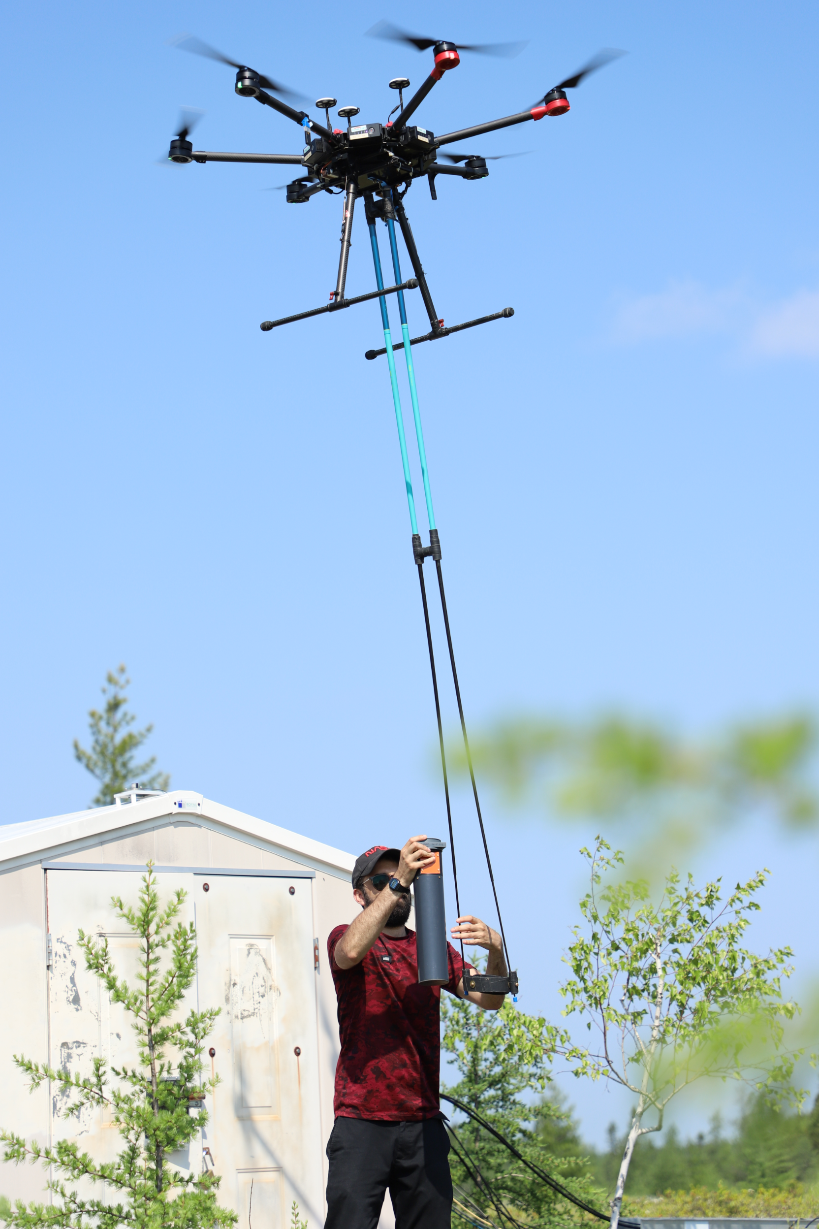
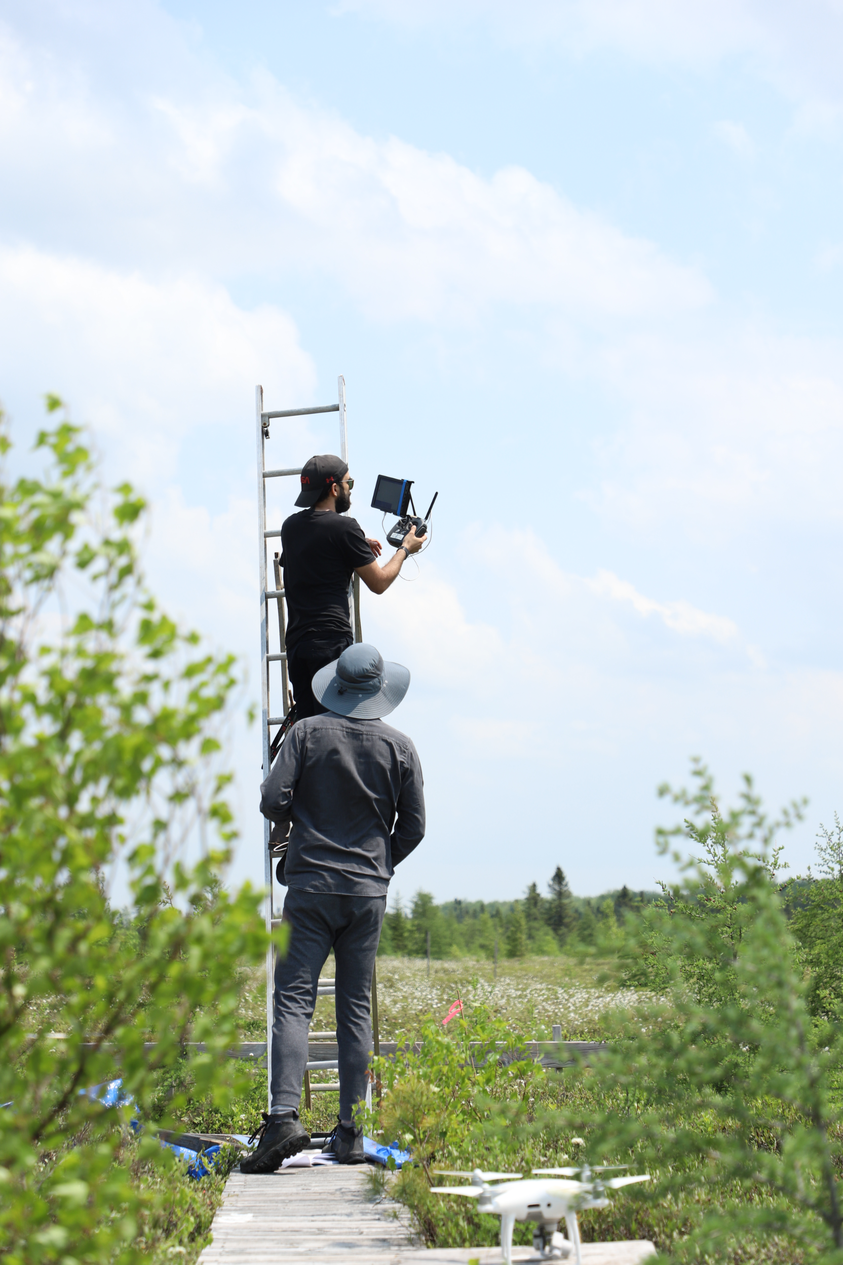
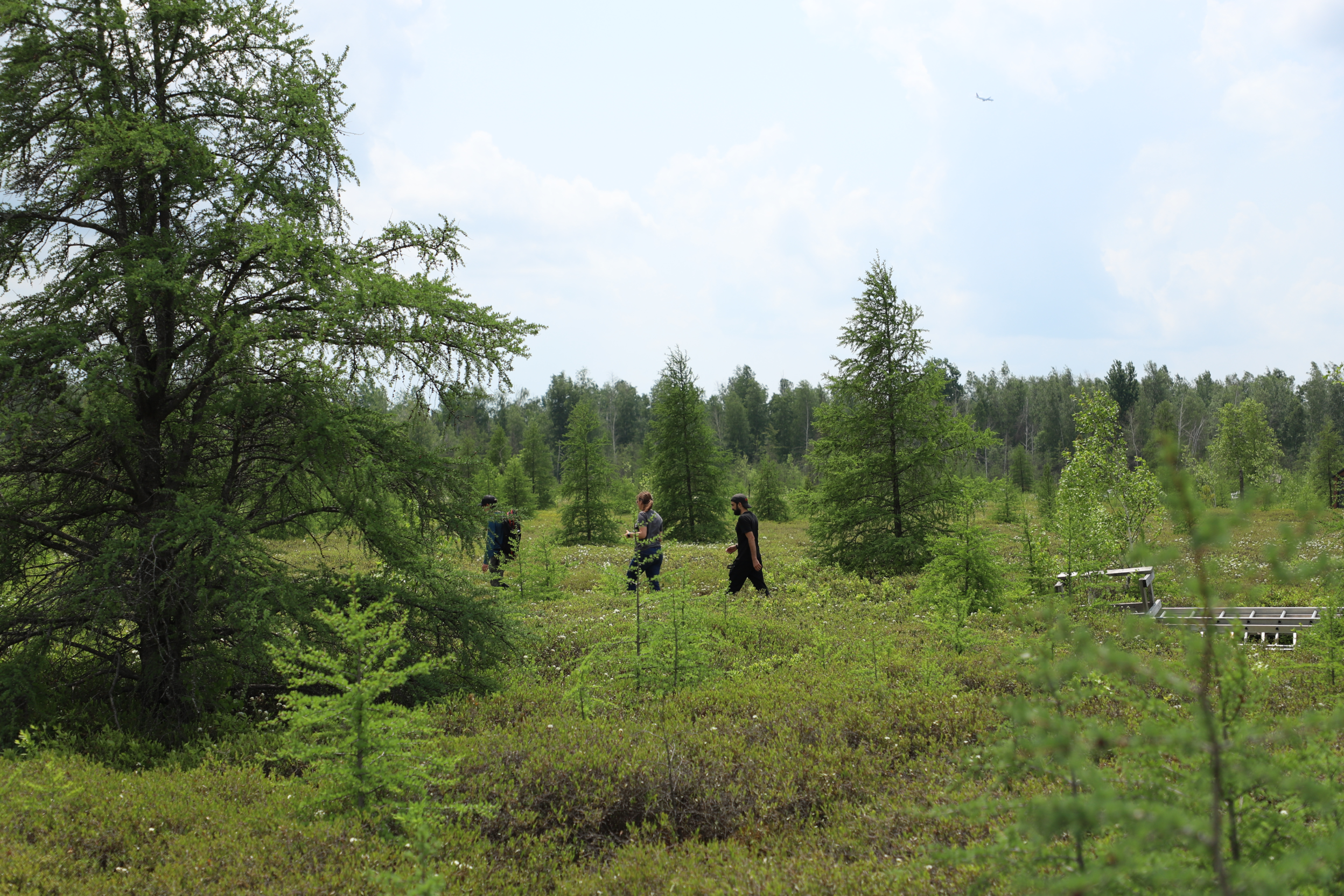
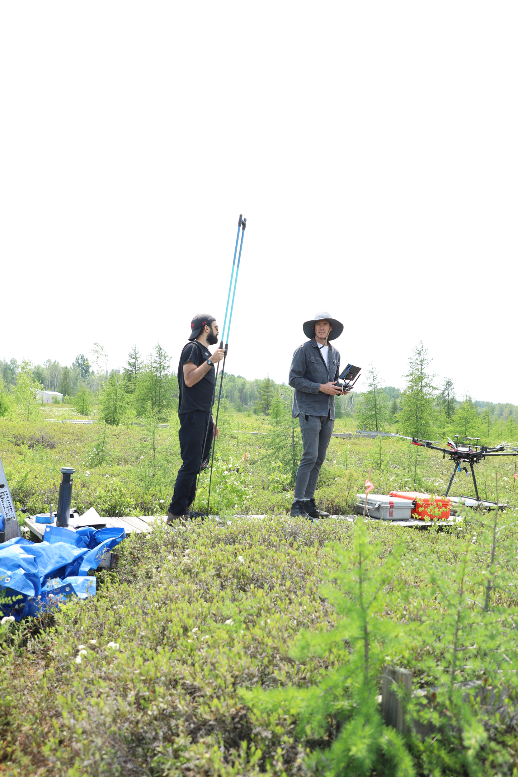
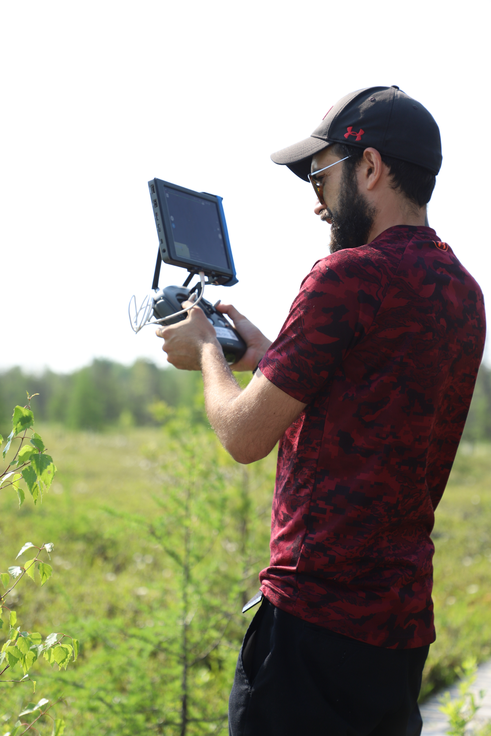
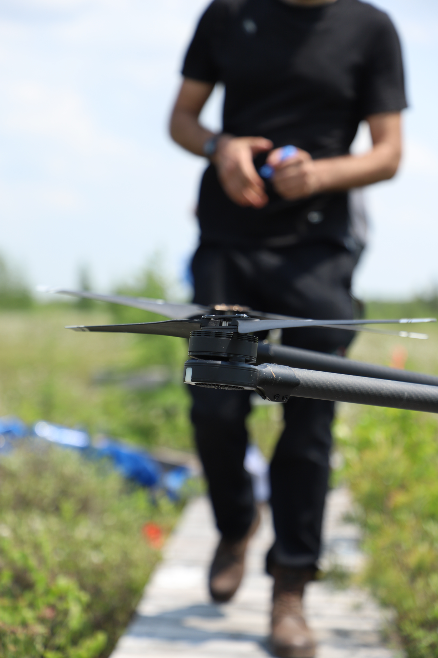
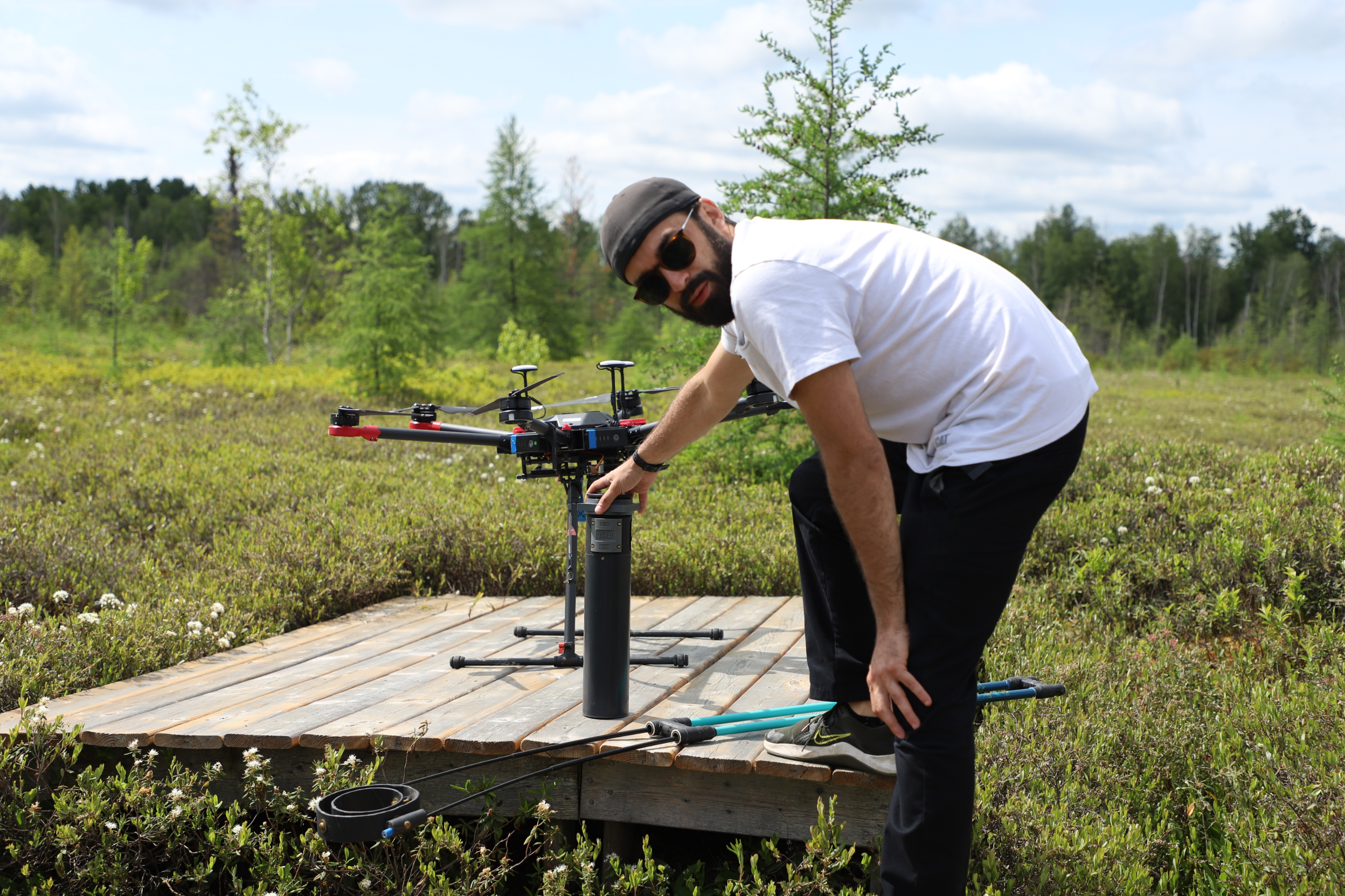
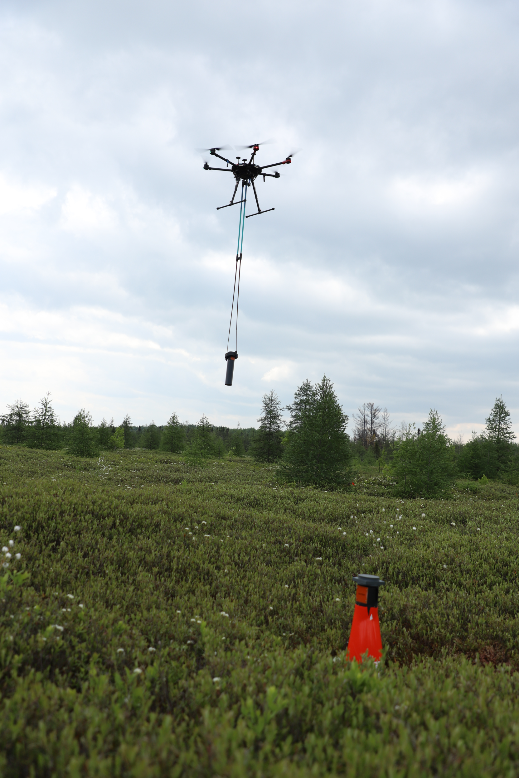
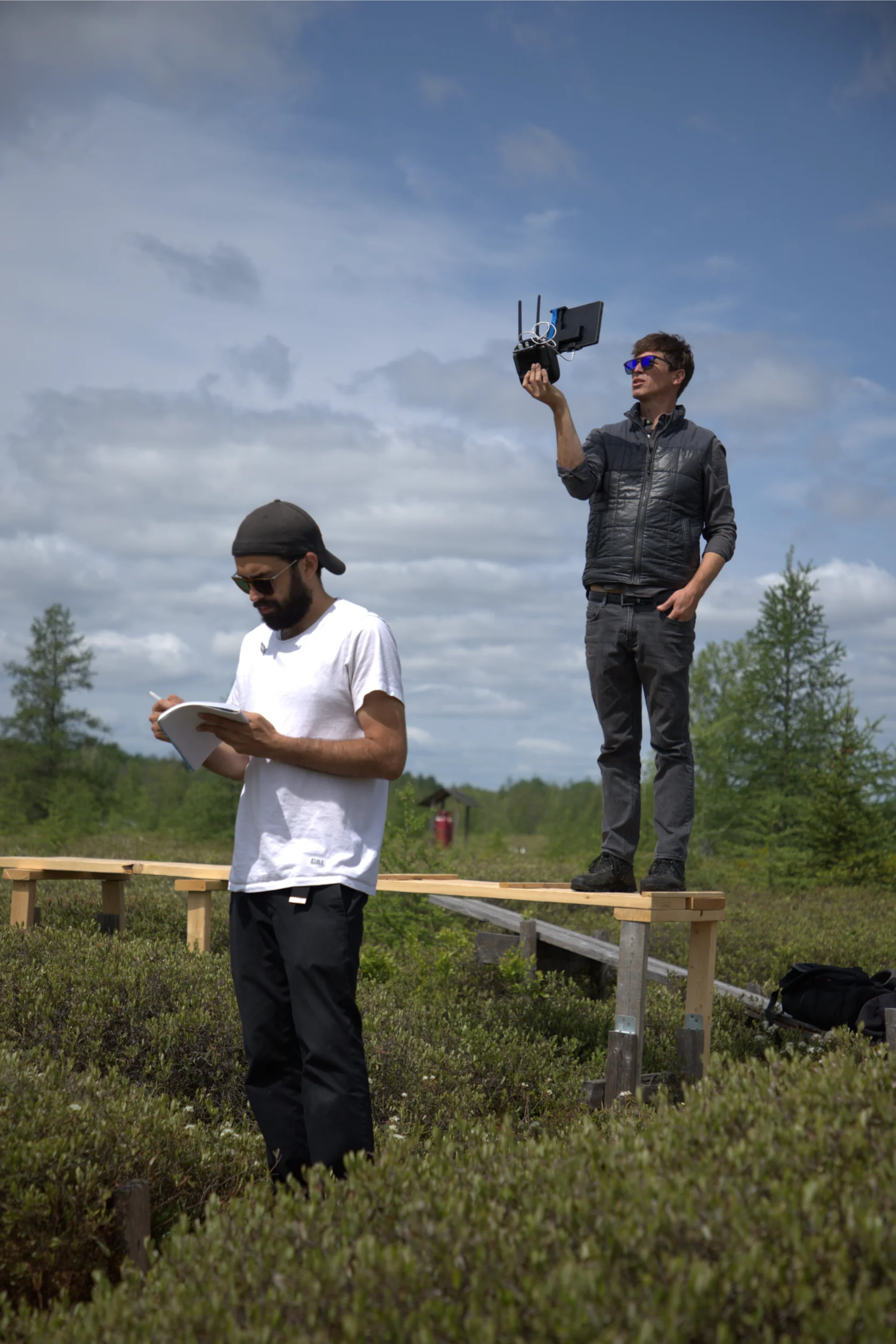
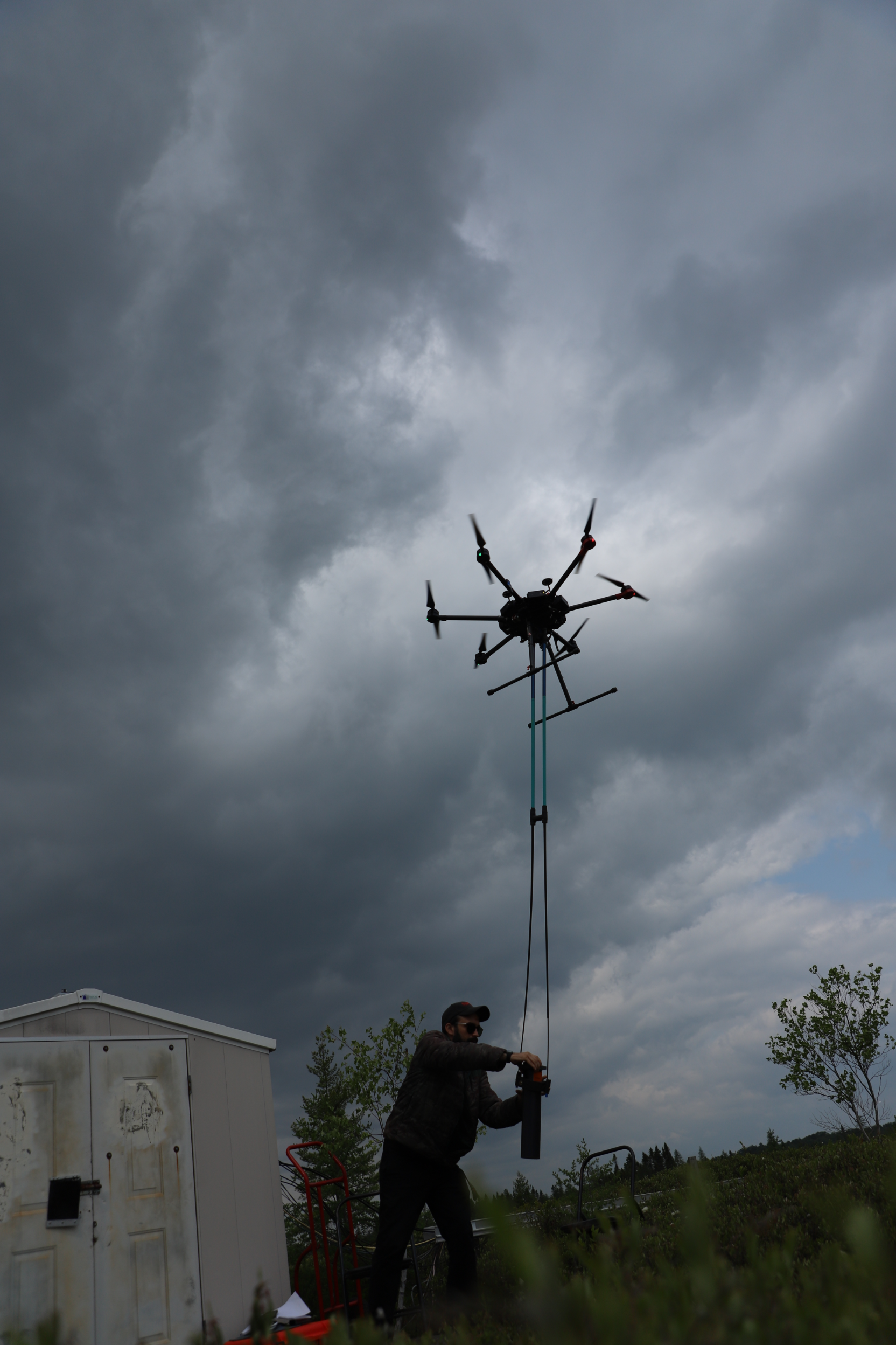
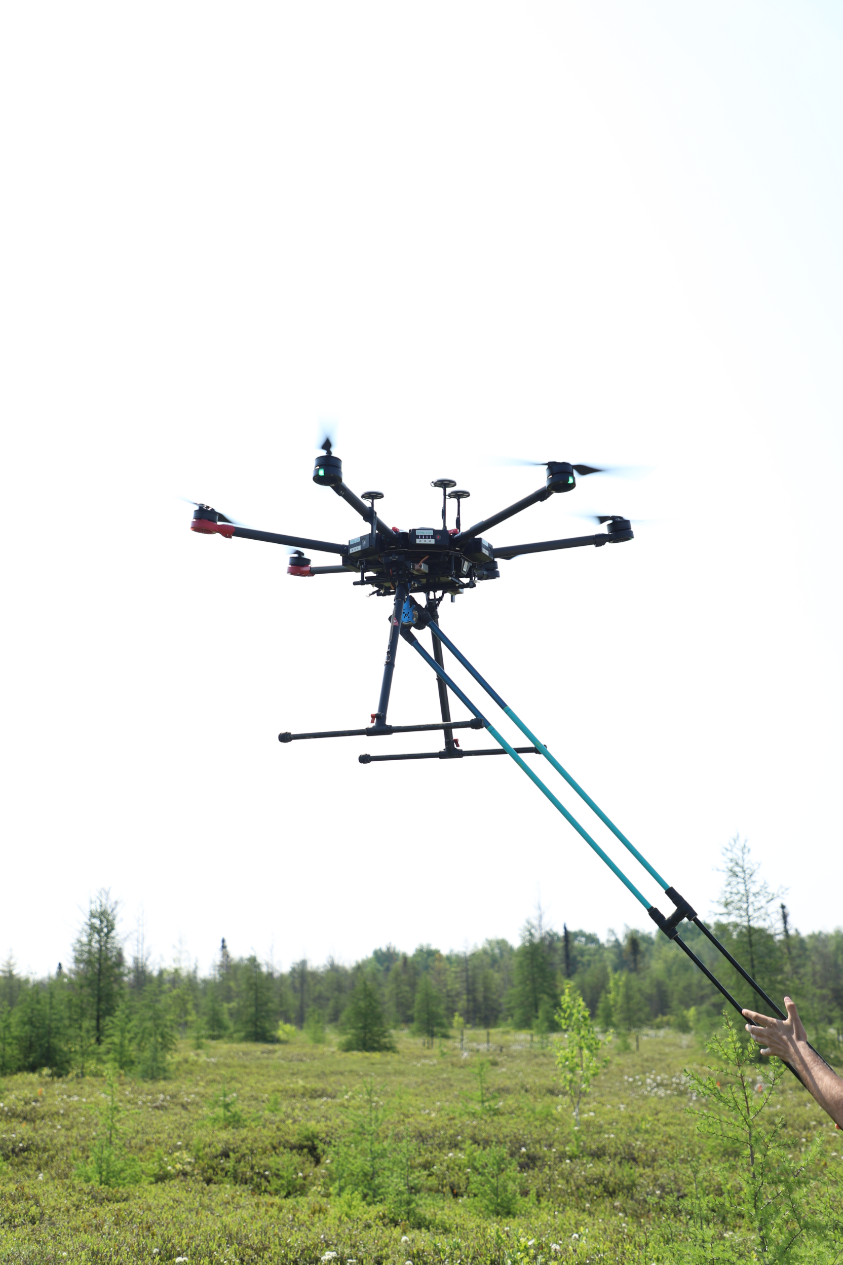
In 2025, 3XMAG Technologies successfully completed a pioneering field pilot project and hosted two strategic briefings for the Mer Bleue UXO site in Ottawa, demonstrating the practical power of UAV-based magnetometry and radiometry for unexploded ordnance (UXO) detection in a complex wetland environment.
The Investor & Business Briefing invited researchers, public sector agencies, industry innovators, and forward-thinking investors to explore how this pilot project paves the way for next-generation geophysical survey solutions. Rather than pitching a product, we opened the floor to collaborative discussion on partnership pathways, market gaps in historic remediation and defense geophysics, and shared opportunities for research and tech co-development — including AI, machine learning, and real-time anomaly detection.
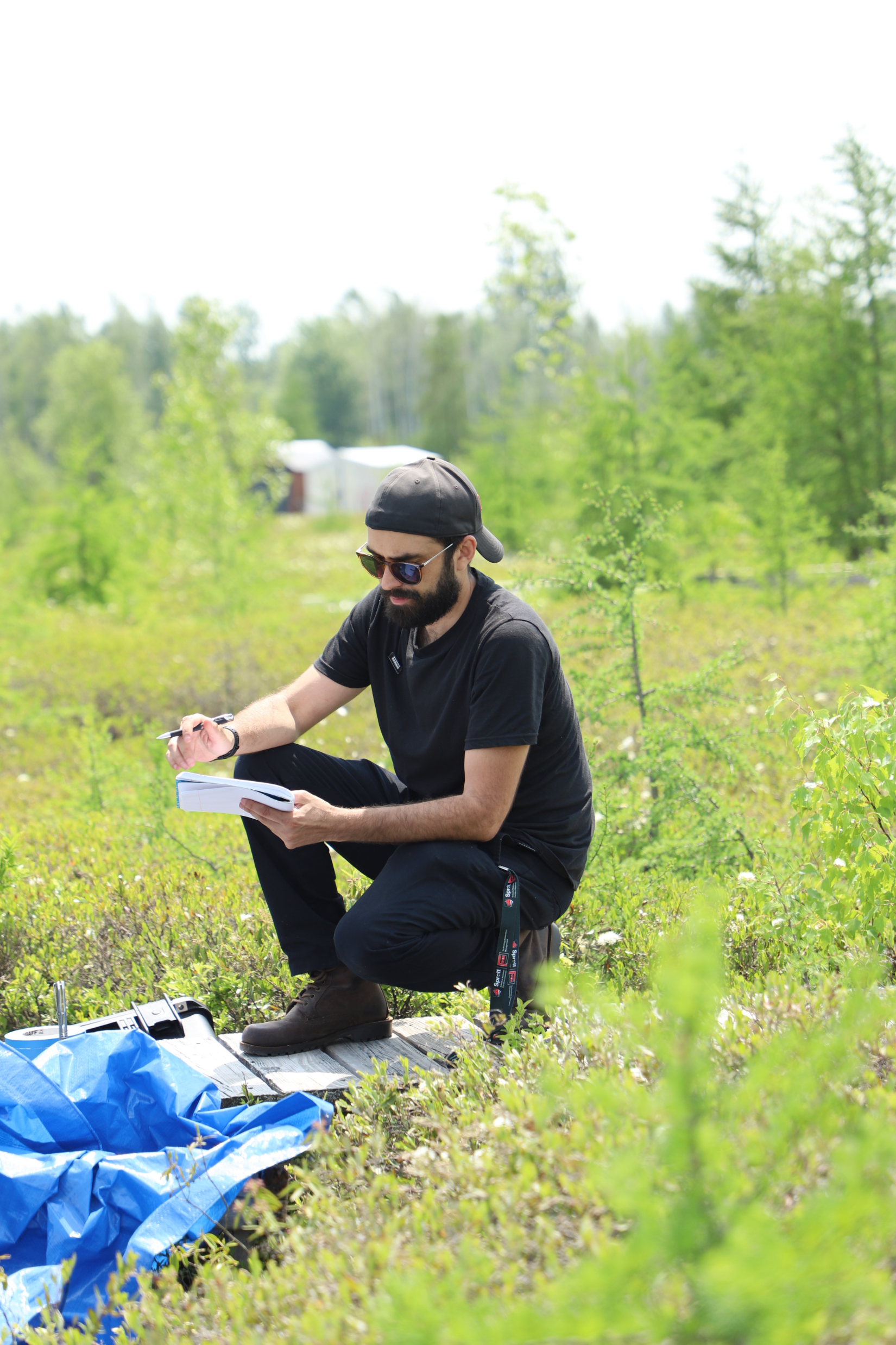
Meanwhile, the Tech & Operators Briefing brought together UAV pilots, field techs, GIS analysts, and scientists for a practical look at how the mission was planned and executed — covering everything from regulatory navigation and custom flight paths to multi-sensor integration and the challenges of operating in difficult wetland terrain. This open session gave participants valuable insights into our mission workflows, data fusion strategies, and our roadmap toward automation and real-time visualization.
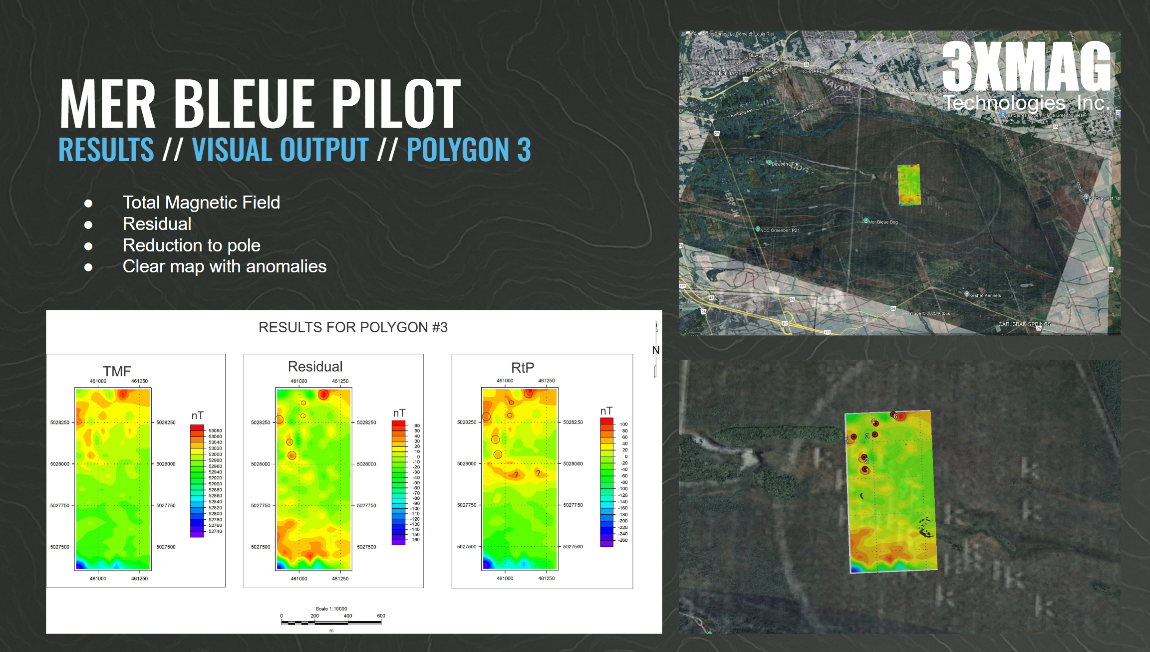
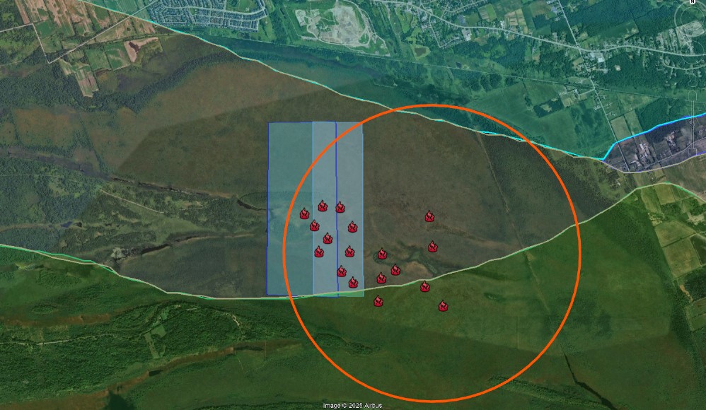
As a result, the Mer Bleue UXO Detection Pilot achieved:
-
- 4 days of safe UAV operations with zero environmental disturbance
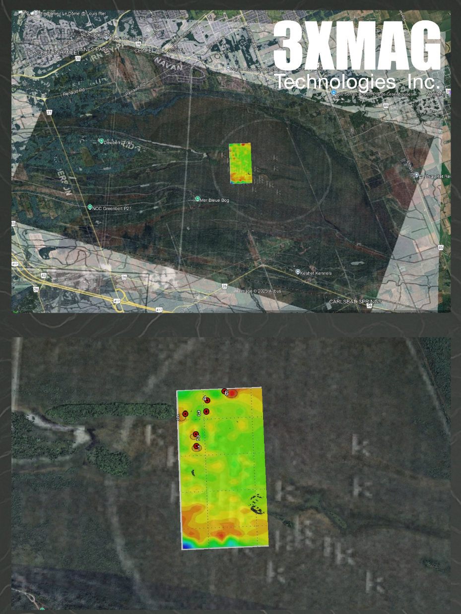
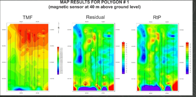
- Over 125 acres of high-resolution subsurface data captured in a sensitive bog ecosystem
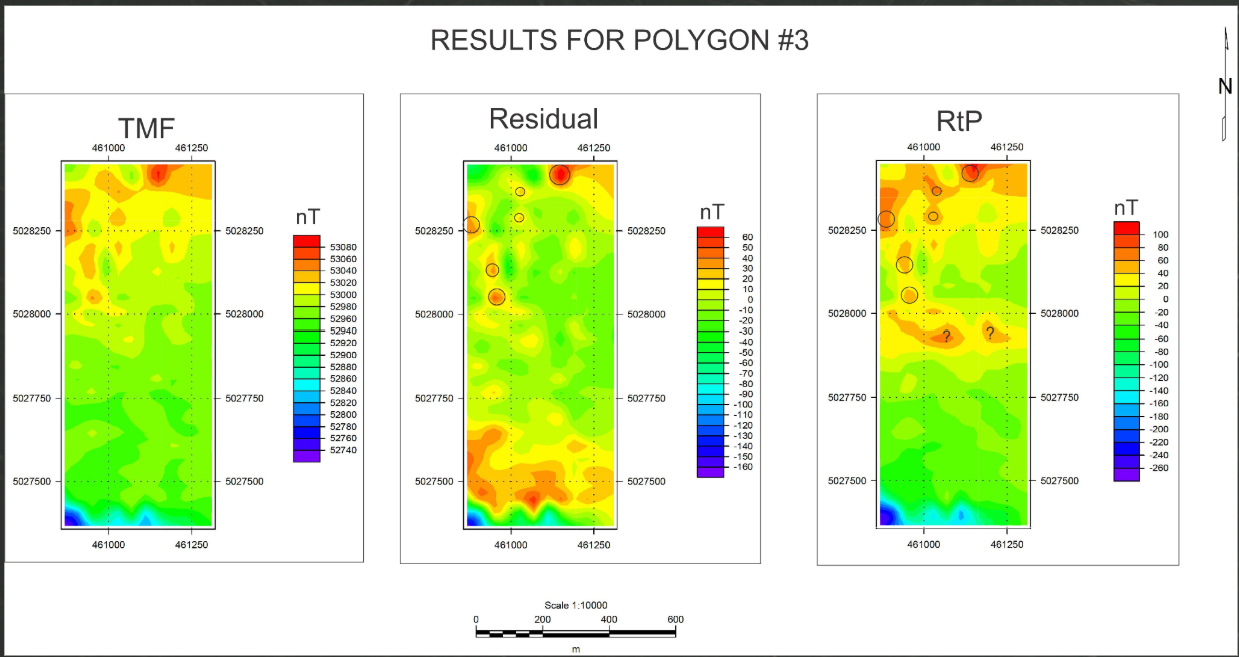
- Identification of a UXO corridor consistent with WWII bombing test areas
- Confirmed magnetic anomalies now targeted for follow-up validation
- Integration of new datasets with historical LiDAR to assess terrain change and UXO migration patterns, refining detection algorithms for future missions
Together, these successful briefings and field operations show that our technology is not just conceptual — it’s field-tested, adaptable, and ready to scale. We’re now building strategic partnerships with defense, public safety, environmental monitoring, and infrastructure sectors to drive the future of UAV-based geophysical surveys.
Download the full report to see the detailed results — and sign up to join us as we advance safer, smarter, and more sustainable subsurface mapping solutions.
Continue to explore the results, photos, and resources
Dive deeper into our Mer Bleue UXO Detection Pilot, review the briefing descriptions, see field photos and videos, and access exclusive resources and the full report.
Innovation on the spot
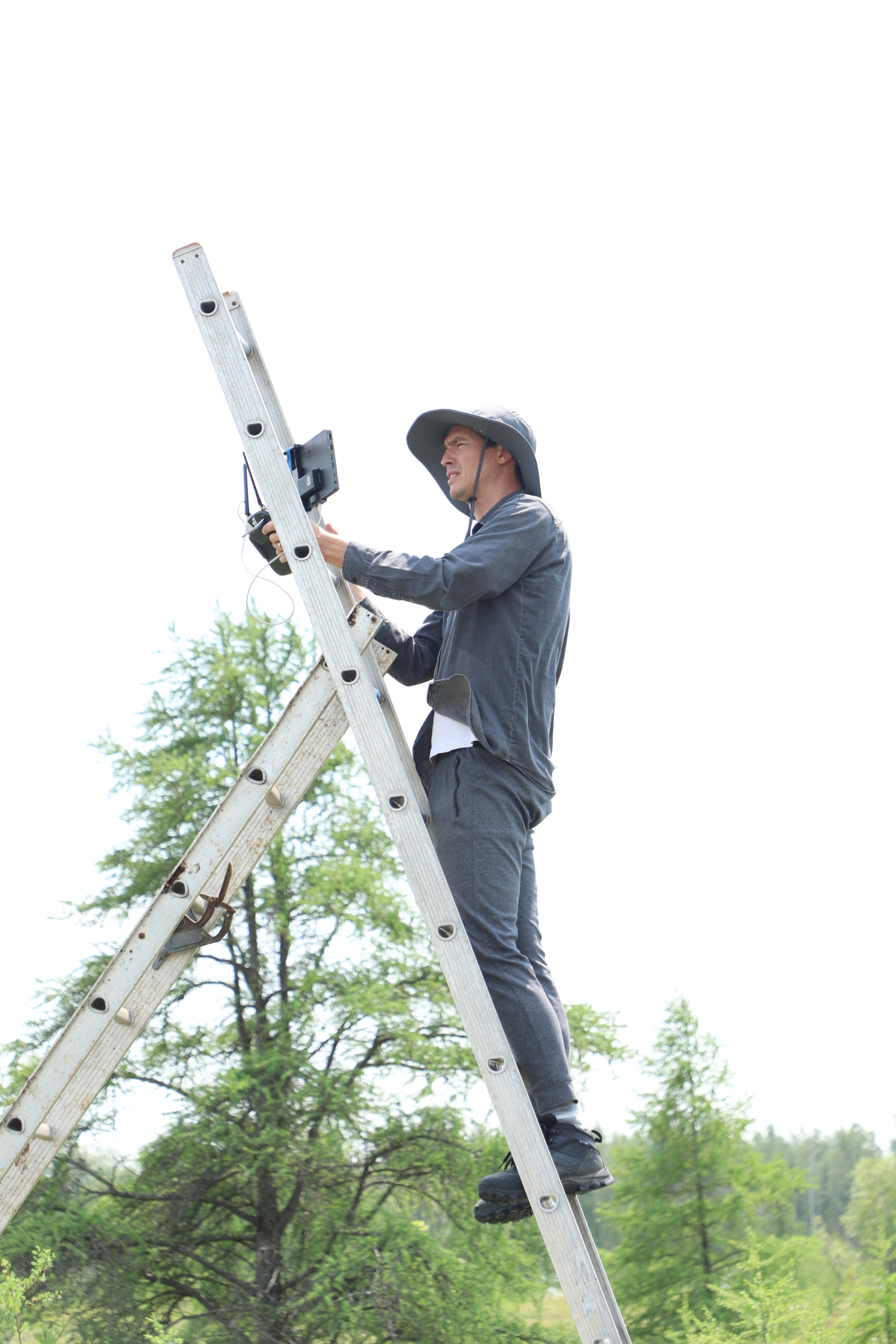
This video showcases how innovation is proven in the field at Mer Bleue through practical deployment of semi-automated geophysical workflows. Using our custom UAV-based triaxial magnetometry and radiometry platform, we’re demonstrating real-time data decoding, pre-processing, and automated QA/QC to streamline complex subsurface exploration.
We believe that by supporting the workflow/workload of operators by validating, correcting, and integrating raw data on-site, we can efficiently reduce errors and accelerate computations, creating faster, cleaner visualizations for decision-makers. Each step, from sensor calibration to flight operations, is designed to push geophysics toward smarter, safer, and more accessible workflows.
“This is where the future of UAV-enabled geophysical prospecting is heading: modular tools, intelligent processes, and actionable insights — all proven where it matters most, in the field. But this is just the first step.”
KEY ELEMENTS OF VIDEO
– Semi-Automation
– Decoding and Pre-Processing
– Validation and Corrections
– On-site Integration
– Better Visualization & Decision Support
– Proven In Situ
“The Mer Bleue UXO Detection Pilot is a collaboration between 3XMAG Technologies, Carleton University, and other strategic partners to validate cutting-edge exploration technology for detecting unexploded ordnance (UXO) in one of Ottawa’s most sensitive wetland ecosystems. Using aerial magnetometry, radiometry, and advanced data processing, this project lays the groundwork for integrating AI into future detection workflows.”
This pilot serves as a proof of concept and a thorough risk assessment, demonstrating how UAVs and scientific intelligence can significantly reduce field risks and environmental impact — while maximizing cost efficiency, time savings, and data quality for critical subsurface exploration missions.
SUBSCRIBE & DOWNLOAD
THE REPORT HERE

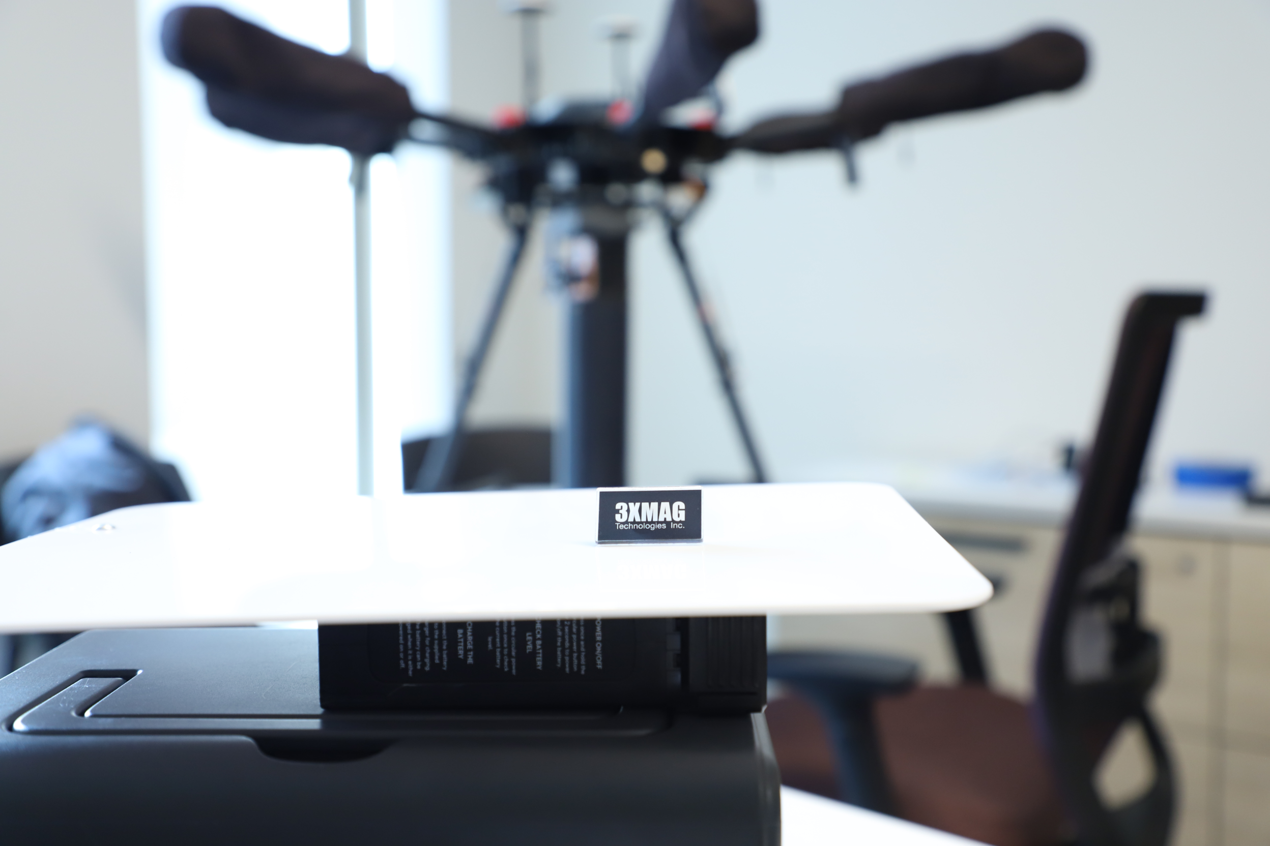
3XMAG
Technologies Inc.
Join us on the journey to the future of geophysics, magnetometry and radiometric exploration.
Contact 3XMAG
Sign up for news
Questions? Email me at pablo@3xmag.ca

Pablo Arzate – 3XMAG Technologies Inc. CEO & CTO
Pablo Arzate is a multidisciplinary innovator and the founder of 3XMAG Technologies Inc., a venture at the forefront of UAV-based geophysical intelligence. With over a decade of experience spanning industrial design, R&D, and advanced manufacturing, Pablo leads the development of sensor-integrated drone platforms that deliver cutting-edge magnetometry, radiometry, and AI-powered analytics for critical applications in mining exploration, historical remediation, and public safety.
Pablo holds a Master of Engineering and Design in Design Thinking and Additive Manufacture and is currenlty going through a Technology Innovation Managment masters at Carleton University and has led design and prototyping projects across aerospace, defense, and scientific research domains. His work uniquely bridges technical depth and design thinking, enabling the creation of scalable technologies that solve real-world problems—like UXO detection in post-military landscapes or rapid subsurface mapping in resource exploration zones.
With partnerships across academia, industry, and government—including Carleton University, AV3, LEMI, Kromek, and potentially the Canadian Nuclear Laboratories—Pablo’s leadership is driving the transformation of geophysical surveying into a faster, safer, and more accessible practice for clients around the world.